
Colombia has an important technological tool to identify ecosystems that are vulnerable to deforestation and thus be able to prevent them and avoid other environmental crimes.
This tool is of great importance in the framework of the fight against global warming that our country is doing to comply with the Paris Agreements.
It is the Ideam Institute for Hydrology, Meteorology and Environmental Studies’ Forest and Carbon Monitoring System that generates information that serves as input for the actions of the National Council against Deforestation and Other Environmental Crime.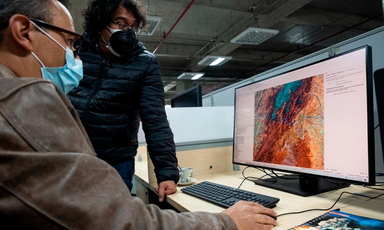
The identification of active cores of deforestation, especially those resulting from illegal activities, is one of the purposes of the Ideam Forest and the Carbon Monitoring System, an essential tool for coordinating actions that allow the restoration and protection of Colombian ecosystems.
“At the National Council for Combating Deforestation, Konaldiv, we are responsible for formulating strategies to protect our forests. The Artemisa campaign is one such campaign, which, in a joint effort of the Attorney General’s Office, military forces and the entire environmental sector, has managed to control 14,238 hectares of forest that Forests removed.
For this, the satellite information generated by the forest monitoring system was vital,” emphasized the Minister of Environment and Sustainable Development, Carlos Eduardo Correa.
Through images from the Sentinel, Landsat and Planet Scope satellites, many of the most important satellites for detection, this system not only determines the geographical location of areas of deforestation, but also provides multi-time analysis of the loss process even weekly. and quarterly reports of early discoveries in near real time.
Some of the areas that have experienced a high rate of deforestation that have been brought under control thanks to the actions of Conaldef and as part of the Artemisa campaign are Tinigua National Natural Park, Sierra de La Macarena National Natural Park in Meta, Amazon Forest Reserve Area and Serranía de Chiribiquete National Natural Park between Caquetá and Guaviare Provinces. .
Similarly, in the first quarter of 2021, progress was made in controlling deforestation in three active cores prioritized by the national government: Jari Sur and El Camuya, in Caqueta Province, and Kalmar Miraflores, in Guaviare Province.
In order to reach the goal of total deforestation by 2030, the Environmental Portfolio will continue to join forces to strengthen effective monitoring and response in favor of protecting Colombian forests.
sowing
The monitoring system can also serve as a tool for planning programs that promote reforestation in different areas of the country.
Specifically, the Ministry of the Environment, along with the military, local communities and the private company, have planted more than 60,000 trees in nine regions of the country, including Valle del Cauca.
The goal is to conserve the country’s water resources and thus protect the trees which play an essential role in the hydrological cycle.
Sowing was carried out in Bogotá and in the provinces of Cundinamarca, Valle del Cauca, Antioquia, Boyaca, Bolivar, Atlantico, Santander and Norte de Santander.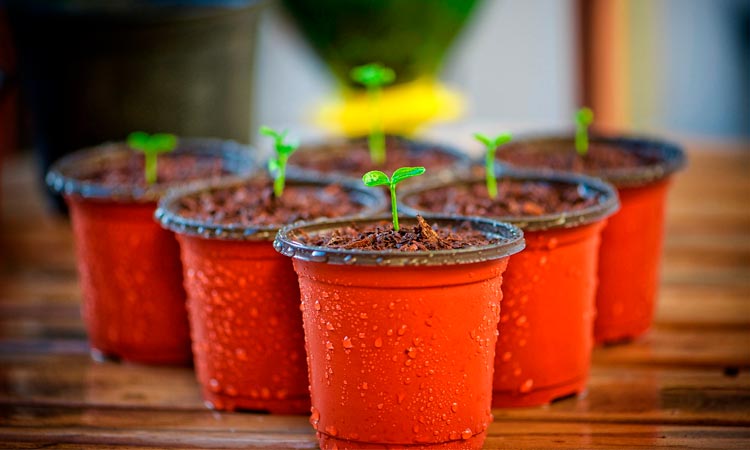
The national government has proposed planting 180 million trees by 2022 and about 62 million trees have already been planted, within policies to combat deforestation and mitigate climate change.
Planting trees provides great benefits to the environment, as trees play an essential role in the hydrological cycle, as they contribute to the regulation of water by storing it in times of rain and making it available in times of drought.
In addition, it contributes to its filtration through roots and leaves to reduce soil erosion and generate multiple additional environmental benefits.
protected areas
On the other hand, Colombia is developing an international cooperation project, with a budget of 20 million dollars, which initially aspired to support the declaration of 550 thousand hectares as protected areas, and it achieved great success in 2021, the penultimate year of its implementation, it has already exceeded this goal By contributing to the declaration of the protection of six million five hundred thousand hectares.
This is the GEF-Sinap project, which has enhanced the planning tools of the National System of Protected Areas Sinap that aligns the range of protected areas, social actors, strategies and management tools it defines, allowing the country to comply with conservation goals and enhance actions to mitigate climate change.
The intervention took place directly in the protected areas of Orinoquia and the northeastern Andes. Of the $20 million project, four million were provided by the Global Environment Facility (GEF), and another 16, by environmental authorities, civil society and the World Wide Fund for Nature.
The project works to improve the management of these areas and promote long-term sustainability, achieving better participation in decision-making with the communities of these areas.
Comments